| 3,390 files in 44 albums with 0 comments viewed 100,215 times |
|
The Wizard of Eagle, August 4, 2007
|

|

|
|
When I heard the roar from the propane blast, I turned from my early morning yard work to see the balloon hovering just a few feet above the neighbor's roof. The gentle southwest wind was carrying the craft on a collision course with my home! So naturally, I ran for my camera! At first I thought the pilot was calling to me, requesting assistance. Then I saw another figure walking along the street and realized the pilot was communicating some instructions to him. I continued shooting away, half expecting the balloon to envelop my home momentarily. I had seen the balloons pass low overhead shortly after sunrise on many occasions, always alerted by the familiar roar, and wondered what would happen if they didn't reach the open areas to the west. To my surprise, the pilot from "I'll Fly Away" in Meridian, brought the craft down exactly where he wanted it, carefully avoiding the street lamp. Ten minutes later the chase crew arrived, the balloon was folded into a container, and they were gone. The neighbor never realized what had happened!
16 files, last one added on Aug 04, 2007
Album viewed 4 times
|
|
|
|
Camel Falls Backpack; Rappel, Tyrolean Traverse April 7, 2007
|
|
|
|
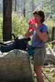
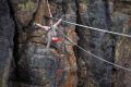
Camel Falls (5361') is situated in a mature juniper forest about 20 miles SW of Grand View, ID. A group of more than 20 carried in gear and provisions on an overnight adventure that included instruction in rappelling, and setting up a Tyrolean traverse. Rain showers failed to dampen spirits at Saturday evening's barbeque over an open juniper fire, which was followed by the traditional burning of the Peeps. An unannounced visit by the Easter Bunny resulted in a grand egg hunt following a delicious breakfast of turkey, ham and cheese on bagels (for those observing Passover) toasted expertly over the coals by chef Debbie. Leo Hennessey led some of the group on a reconnaissance of the surrounding area Sunday morning. Kudos to Mike and Debbie Allen for organizing an outing that was informative, rewarding, and great fun.
78 files, last one added on Apr 09, 2007
Album viewed 17 times
|
|
|
Tributary Canyons; West of Big Jacks Creek, March 24, 2007
|
|
|
|
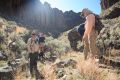
We parked at 42 deg 39.97 min N, 116 deg 03.00 min W. The group of approximately 12, led by Mike Allen descended SE to Big Jacks Creek, then retraced ourr tracks and climbed another tributary canyon that branched SW. After lunch, we split up; some returned the same way, while the rest continued SSW. Further up, the canyon forked again and we navigated W. When the vertical canyon walls diminished, we ascended SE over the ridge and dropped into the other fork, following it back down. Eventually, we briefly ascended yet another tributary to the NW, not far from the original entry point that began the hike. Climbing N out of the canyon brought us back to our cars, a total distance of around 7 miles.
28 files, last one added on Mar 25, 2007
Album viewed 11 times
|
|
|
Upper Browns Creek, Hart Creek slot canyons March 11, 2007
|
|
|
|
Warm, sunny weather and a lower than average flow combined to make this ascent of upper Brown's Creek and Hart Creek a pleasant late winter adventure southwest of Oreana east of the Owyhee Mountains. Some passages in the canyon are only 12 feet wide. One can expect to wade cold waist-deep water, climb slick, exposed rock, bushwhack a section of rose bushes, and skirt poison ivy. The upper Brown's Creek hike was about one mile, starting in the vicinity of 42 deg 57.7 min N; 116 deg 26.3 min W. The Hart Creek slot is about 1/2 mile long, but involved steeper climbing and deeper water. We started near 42 deg 58.0 min N; 116 deg 32.5 min W.
37 files, last one added on Mar 12, 2007
Album viewed 6334 times
|
|
|
|
Trail Creek Snowshoe March 3, 2007
|
|
|
|
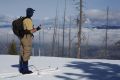
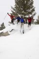
This four mile intermediate level loop snowshoe climbs steeply north from Warm Lake Highway, about 1.8 miles east of Big Creek Summit east of Cascade (44 deg 38.126 min N, 115 deg 46.753 W long, elevation 6210'). The group, organized by Leo Hennessey, climbed about 1000', traversing back and forth along a rock fin to a point about 0.2 miles northeast of a peak marked 6591' on the USGS 7.5 minute topo. After lunch, we found a steep drop where the more ambitious could get some air, freefalling into seven foot drifts at the base of the outcrop. A 600' slope to the east was descended into a densely wooded canyon. We followed a stream flowing south for 1.3 miles, then climbed south to regain the highway. The group relaxed in a hot spring a bit further east along the road.
36 files, last one added on Mar 07, 2007
Album viewed 4 times
|
|
|
| 43 albums on 4 page(s) |
|
4 |
|
|
|

IMG_5887.JPG4 views
|
|

IMG_0847.jpg125 viewsHe's too sexy for his shirt!
|
|

IMG_1366.jpg123 viewsBaron Spire
|
|

IMG_5219.JPG5 viewsOne of several hydrothermal pools on the northwest section of the Artist Paint Pots trail.
|
|

IMG_0053.JPG0 viewsWider view of the divide we visited yesterday northeast of our camp at Kidney Lake.
|
|

IMG_3279.JPG14 viewsDisappointing destination; I did not find my lost items- somebody else did! The land bridge at Twin Lakes.
|
|

IMG_7482.JPG3 viewsSmoke from the nearby 'Roaring Fire' northeast of Big Clear Lake obscures the view of Cathedral Rock (center) in the distance.
|
|

IMG_4349.JPG839 views
|
|
|
|

DSCF1097.JPG2 viewsThis tarn is at an elevation of 9730', well above Fourth of July Lake. The water is a bit brackish, but will do in a pinch. I hear from more than one party ascending from the Fourth of July trail head that the road from Stanley to Grandjean was is still closed. I'm making good time, and will be able to make the most of the remaining light, getting to Ketchum just as it is getting dark. I reach the trail head at 7:30 pm, completing the "epic White Cloud backpack loop" for the fourth time.Sep 09, 2024
|
|

DSCF1095.JPG2 viewsFourth of July Lake to the S.Sep 09, 2024
|
|

DSCF1094.JPG4 viewsDescending toward Fourth of July Lake from the top of the ridge SW of Ants Basin, looking W across the Sawtooth Valley. One can see the smoke from the Wapiti fire S of Stanley on frame right (N). Yesterday I was told the road from Stanley to Grandjean was still closed. I'm hoping that has changed, but not counting on it.Sep 09, 2024
|
|

DSCF1093.JPG1 viewsShadows drifting across the face of WCP-8 (10557') from the top of the ridge SW of Ants Basin. (58 mm)Sep 09, 2024
|
|

DSCF1089.JPG2 viewsThe familiar orange band I navigated toward the first day to the trip descending Strawberry Basin to Warm Springs Creek from the top of the ridge SW of Ants Basin. (200 mm)Sep 09, 2024
|
|

DSCF1087.JPG1 viewsWCP-8 (10557') from the top of the ridge SW of Ants Basin. (95 mm)Sep 09, 2024
|
|

DSCF1086.JPG1 viewsThe pinnacle immediately S of the Devil's Staricase from the top of the ridge SW of Ants Basin. (200 mm)Sep 09, 2024
|
|

DSCF1084.JPG1 viewsWCP-8 (10557') above the Warm Springs Creek drainage. The constantly changing light and shadow drifting across the limestone face provide photo opps.Sep 09, 2024
|
|